


Current projects
Sorted alphabetically. Tip: Press Crtl+F for easy search in the project list.
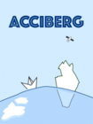
ACCIBERG (Arctic Cross-Copernicus forecast products for sea Ice and iceBERGs
Cordis: https://cordis.europa.eu/project/id/101081568
Project aims: The Arctic ocean will always be extremely dangerous. Sea ice and icebergs are a major risk in Arctic waters; therefore, forecasting and monitoring them is crucial. While the Copernicus Marine and Climate Change Services can provide this information, users may not benefit from it as intended because of a lack of consistency and uncertainty estimates. The EU-funded ACCIBERG project will address this issue. It will develop a new iceberg forecast service using remote sensing algorithms, data assimilation and cloud computing, and consistently offer probabilistic sea ice and iceberg forecasts based on Copernicus data. The new forecasts will be automated and used by various groups navigating in the Arctic – from fisheries to cruise tourism.
Funding: European Commission Horizon Europe Programme for Research and Innovation
Period: 1 Jan 2023 - 31.Dec.2026.
Collaborators: NERSC (Coordinator), Met.NO, Mercator Ocean, ECMWF, CNR-it,
Participants from DMI: Jørgen Buus-Hinkler, Till Rasmussen,
Arctic PASSION (Pan-Arctic observing System of Systems: Implementing Observations for societal Needs) - Horizon 2020
Cordis: https://cordis.europa.eu/project/id/101003472
Project aims: Arctic PASSION will address the urgent need for coordinated and accessible Earth observation and information services for the Arctic region. Despite significant international effort in the past, elements of the current pan-Arctic observing network still remain fragmented, disconnected, or have other critical shortcomings. Our aim is to overcome these shortcomings and to advance towards a fully integrated pan-Arctic Observing System of Systems (pan-AOSS). Working under the SAON framework and in partnership with rights-and stakeholders, Arctic PASSION will strengthen international scientific observations, community-based monitoring, and Indigenous knowledge and local knowledge within an observing system. We will co-create an innovative pan-AOSS that truly represents the diverse range of needs of the different user-groups and decision makers.
The resultant pan-AOSS will provide its users with unrestricted access to the latest-available Arctic observations, including better access to Copernicus Arctic products. It will empower Arctic communities, policy makers and industries to make knowledge-based decisions. These will benefit society and support the adaptation and sustainability of the objectives of the UNFCCC, the IPCC and associated protocols.
Arctic PASSION will also fill critical gaps in observations and improve the archiving, handling and interoperability of Arctic data systems. It will use these improvements to develop and implement eight new EuroGEO Pilot Services that will support emergency preparedness, food security, and responses to climate and socio-economic changes in the Arctic.
The combination of the work performed by Arctic PASSION will provide compelling evidence to GEO to update Arctic GEOSS’ Community activity’ to the higher level of GEO ‘Regional Initiative’. Our legacy will be a stronger European voice in Arctic observing, and a more inclusive pan-Arctic observing system that supports a prosperous, sustainable and environmentally secure Arctic.
DMI's role:
WP1 - Enhancing and unifying Arctic observation
Focus: Improve, unify, and expand existing observational networks across marine-terrestrialcryosphere-atmosphere spheres, with in-situ observations, remote sensing & CBM.
WP4 Euro GEOSS Pilot Services
Focus: Co-develop and implement 8 new, end-user driven Pilot Services and their coordinated network, focusing on climate change, reducing risk and support adaptation and sustainability.
DMI is specifically involved in:
Developing and implementing a service for ‘Community engagement in monitoring of marine noise pollution, management and advice’ (Lead Malene Simon, GCRC), jointly with local communities of NW Greenland (Qaanaaq, Savissivik, Siorapaluk, Qerqertat).
Improved safety of shipping in ice covered waters by implementation of real-time risk maps based on the IMO’s POLARIS11 risk assessment system. Co-developed with national ice-services, ship operators, insurers, and marine safety organisations.
WP8: Co-developing a unified a pan-AOSS
Focus: Synthesize outputs to provide a strong contribution to unify Arctic observations,
Copernicus services, initiate an ArcticGEOSS with SAON and the European Polar Coordination Office.
Funding: European Commission H2020 Programme for Research and Innovation
Period: July 2021 - June 2025.
Collaborators: AWI (Coordinator) and 30 other.
Participants from DMI: Steffen Olsen, Jacob Høyer, Matilde Kreiner, Rasmus Tonboe, Keld Qvistgaard.
Copernicus Marine Service for the Baltic Sea (BAL MFC)
(Link: http://marine.copernicus.eu )
(continuation of the previous project period, with same collaborators)
Project aims: To deliver and operate a robust, sustainable and state of the art ocean monitoring and forecasting service for the Baltic Sea as part of EU’s Copernicus Marine Service that covers both the Global sea and the European waters.
DMI's role: DMI plays an active role in project management, operation, service and scientific development of the Baltic Sea component of the EU's Copernicus Marine Service. DMI is the coordinator of the Baltic Sea Monitoring and Forecasting Center (BAL MFC). DMI will, among others, be responsible for a production of a new long time model re-analysis of the physical and biogeochemical conditions in the Baltic Sea. Simulations wil start back from 1980 an continue to present time. New knowledge will hopefully be gained on data assimilation and ocean and ice modeling in the Baltic Sea; resulting in improved model products for the users of this free and open Service.
Funding: BAL MFC is a project with 3.65 million euro contracted with MERCATOR Ocean International, France, who has been delegated the overall task by the European Commission to implement EU’s Copernicus Marine Service.
Period: (new) December 2021 - December 2024.
Collaborators: DMI, BSH (Germany), FMI (Finland), TalTech (Estonia) and SMHI (Sweden).
Participants from DMI: Vibeke Huess, project leader, Jun She, Ida Ringgaard, Jens Murawski, Vasily Korabel
CARRA Timely Update (Copernicus Arctic Regional ReAnalysis Timely Update)
Project aims: CARRA-TU provides a near-real time update of the Arctic atmospheric reanalysis for the European arctic regions including Greenland Icesheet, Iceland and Svalbard. The project is a continuation of the production for the 30 year Copernicus Arctic Regional Reanalysis (CARRA) for the period 1991-2020. Using the Harmonie-arome based reanalysis system, high resolution reanalysis is conducted using the same system configuration, with assimilation of an unprecedented amount of in-situ observation data for the region, including those collected over the Greenland icesheet. The CARRA reanalysis also makes use of large amount of upper air observation data including satellite remote sensing. CARRA-TU is scheduled to provide update about the regional atmospheric reanalysis with a maxmium of 3 month delay. During the CARRA-TU, work will also be done to postprocess the 30-year CARRA reanalysis to derive climate statistics to improve usefulness to climate research community.
DMI's role: Together with Met.no, the coordinator of the CARRA-TU project, DMI is the main contributor to the CARRA-TU project and participate in all work packages. DMI leads work package on reanalysis system including tasks to ensure regular and timely observation data collection, migration of the CARRA reanalysis system to the newly established ECMWF High Performance Computation Facility, and the algorithm development for computation of climate statistics. DMI contribute with delivery of near real time high resolution sea state information combining ESA-CCI and OSISAF reprocessed sea ice cover and sea surface temperature, delivery of the ROM-SAF radio occultation bending angle data, as well as collection and quality assurance of in-situ observation data for the Greenland area by DMI, ASIAQ, GCNET and PROMICE. DMI contributes to the monthly organisation of observation data collection and preparation, the reanalysis production and monitoring fot the near real time stream.
Funding: The Copernicus Climate Change Services (C3S) programme, which is a programme initiated by the EU commission.
Period: 1 Jan 2022 - 31 Dec.2025.
Collaborators: Met.NO (det norske meteorologiske institutt), DMI, SMHI, GEUS, IMO (Veðurstofa Íslands), FMI.
Participants from DMI: Xiaohua Yang, Kristian Pagh Nielsen, Carlos Peralta, Bjarne Amstrup, Søren Borg Thorsen, Jacob L. Høyer, Fabrizio Baordo, Ioanna Karagali
C3S2_312a_Lot1 DWD (Copernicus Climate Change Service)
Project aims: The Copernicus Climate Change Service (C3S) is operating the Climate Data Store (CDS) that provides open access to observed quality-assured climate data records. The main aim of the C3S2_312a_Lot1 project (which is a continuation of C3S_312b_Lot1) is to make such climate data records, so called Essential Climate Variables (ECVs), available to the CDS.
For the project there is a focus on variables related to atmospheric physics and the global water and energy cycle. The project includes both the development of the capability to generate such data records, and arrangement of brokering of data records that are already being generated, e.g., by EUMETSAT SAFs, by ESA, or by other organisations. The project also includes documentation, provision of user services, and arrangement of user workshops.
DMI's role: to set up a system for brokering of ROM SAF gridded monthly mean humidity climate data records, both the currently existing reprocessed data sets and the interim data that are being updated on a regular basis. DMI's role also include various contributions to the user services, and participation in the general project team work.
Funding: Copernicus Climate Change Services (C3S), a programme under the EU commission.
Period: February 2022 - July 2024.
Collaborators: DWD (lead),CNR-ISAC, DMI, KNMI, RMIB, SMHI
Participants from DMI: Hans Gleisner, Kent B. Lauritsen
C3S2_312a_Lot3_Ocean (Copernicus Climate Change Service)
Project aims: Continuation of C3S_312b_Lot3 Ocean. The service is dedicated to the ocean ECVs that gathers Sea Level, Sea Surface Temperature, Sea Ice and Ocean Colour ECVs. It ensures the continuity for existing ECVs (SL, SST, SI) that had started under C3S 312a contract. It also addresses a new ECV; Ocean Colour. A total of 9 variables will be produces: sea level, sea surface geostrophic velocities, SST, sea ice concentration, sea ice edge, sea ice type, sea ice thickness, chlorophyll-a and remote sensing reflectance.
DMI's role: DMI is the Sea Ice ECV manager and responsible for the validation of the sea ice concentration, edge and type products along with the target requirement and GAP analysis document and the Sea Ice helpdesk. DMI shall also deliver IST CDR.
Funding: Copernicus Climate Change Services (C3S), a programme under the EU commission.
Period: November 2021 - January 2023.
Collaborators: CLS (lead), Univ. of Reading, PML, UK Met Office, Met.NO, AWI
Participants from DMI: Eva Howe, Matilde Kreiner, Fabrizio Baordo, Gorm Dybkjær, Magnus Barfod Suhr, Luis Flores Vargas
Copernicus-2 Marine Environmental Monitoring Services - Sea Ice Thematic Assembly Center (SI TAC)
Link: https://marine.copernicus.eu/
Project aims: As part of EU’s Copernicus Marine Environment Monitoring Service (CMEMS) the Sea Ice Thematic Assembly Center (SI TAC) is responsible for the collection, processing, qualification and distribution of sea ice data products derived from radiometers (infrared and microwave), scatterometers and Synthetic Aperture Radar (SAR) satellite missions. The SI TAC produce near-real time (NRT) and delayed mode (REP) processing of Sea Ice observations (regionally and globally), required for CMEMS modelling and data assimilation as well as for other downstream applications.
DMI's role: DMI plays an active role in operation, service and scientific development of the CMEMS service. DMI delivers ice charts and iceberg products for the Greenland Waters and a combined ice and sea surface temperature product covering the whole Arctic. During the contract period DMI will further develop and improve these products eg. by utilizing the sensor capabilities of the Copernicus Sentinel-1, -2 and -3 satellites. DMI products are used by different stakeholders to monitor Arctic sea ice conditions and for data assimilation in Arctic ocean and ice models; resulting in improved model products for the users of EU’s Copernicus Marine Service.
Funding: EU
Period: January 2022 - December 2023.
Collaborators: Met.no (Norge, lead), DTU-Space, FMI (Finland), BAS (England) and NERSC (Norge) and others.
Participants from DMI: Matilde Brandt Kreiner (project leader), Ioanna Karagali; Jacob L. Høyer og Jørgen Buus-Hinkler, Tore Wulf
CERISE (CopERnIcus climate change Service Evolution)
CORDIS: https://cordis.europa.eu/project/id/101082139
Project aims: The Copernicus Climate Change Service Evolution (CERISE) project aims to enhance the quality of the C3S reanalysis and seasonal forecast portfolio, with a focus on land-atmosphere coupling. It will support the evolution of C3S by improving the C3S climate reanalysis and seasonal prediction systems and products towards enhanced integrity and coherence of the C3S Earth system Essential Climate Variables.
CERISE will develop new and innovative coupled land-atmosphere data assimilation approaches and land initialisation techniques to pave the way for the next generations of the C3S reanalysis and seasonal prediction systems. These developments will include innovative work on observation operators using Artificial Intelligence to ensure optimal data fusion integrated in coupled assimilation systems. They will enhance the exploitation of Earth system observations over land surfaces, including from the Copernicus Sentinels and from the European Space Agency Earth Explorer missions, moving towards an all-sky and all-surface approach. CERISE Research and Innovation will bring the C3S tools beyond the state-of-the-art in the areas of coupled land-atmosphere data assimilation, observation operators, and land initialisation methodologies.
CERISE will develop diagnostic tools and prediction skill metrics that include integrated hydrological variables to go beyond the traditional skill scores to assess Earth system coupled reanalysis and seasonal prediction. It will deliver proof-of-concept prototypes and demonstrators, to demonstrate the feasibility of the integration of the developed approaches in the operational C3S. The CERISE outputs aim at medium to long-term upgrades of the C3S systems with targeted progressive implementation in the next three years and beyond.
CERISE will improve the quality and consistency of the C3S reanalysis and multi-system seasonal prediction, directly addressing the evolving user needs for improved and more consistent C3S Earth system products.

Funding: European Commission Horizon Europe Programme for Research and Innovation
Period: 1. Jan. 2023 - 31. Dec. 2026
Collaborators: ECMWF (Coordinator), and several other institutes in Europe
Participants from DMI: Xiaohua Yang,
Danish Climate Atlas
EDITO-Model Lab (Underlying models for the European DIgital Twin Ocean) - Horizon Europe
website: https://www.edito-modellab.eu/
Cordis: https://cordis.europa.eu/project/id/101093293
Project aims: EDITO-Model Lab is a project funded by Horizon Europe, for preparing the next generation of ocean models, complementary to Copernicus Marine Service, to be integrated into the EU public infrastructure of the European Digital Twin Ocean (managed in the framework of Horizon Europe Grant to Identified Beneficiaries project) that will ensure access to existing data set (as input and to validate models) already distributed by operational services (from EMODnet, EuroGOOS, ECMWF, Copernicus Services) and that should be centralised on the DTO Marine Data Lake (based on EOSC, WEkEO) and to high performance and distributed computing facilities (from EuroHPC for High Performance Computing and other cloud computing resources) and that will be consolidated under developments of Destination Earth (DestinE).
EDITO-Model Lab will be delivered in 36 months by an authoritative and complementary consortium of 14 partners from 9 countries covering ocean knowledge, modelling and technological expertise. DMI is involved in WP3-model development (co-lead), WP4-Integration of DTO Core Model Suit, WP5- Virtual ocean model lab, WP6-End2end demonstrations for applications and WP7-What-if scenarios (co-lead).
DMI's role: DMI's major activities are further develop DMI's operational, two-way nesting coastal ocean model HBM for DTO on-demand modelling, with facilities for doing what-if scenarios related to marine pollution, sediment transport and nature-based solutions.
Funding: European Commission Horizon Europe Programme for Research and Innovation
Period: Jan 2023 - Dec.2025.
Collaborators: Mercator Ocean (Coordinator), and 11 other partners
Participants from DMI: Jun She, Jens Murawski, Jacob Woge Nielsen
E-GVAP (EUMETNET GNSS Water Vapour Programme; Link: E-GVAP )
Project aims: The purpose of E-GVAP is to provide estimates of atmospheric properties based on data from ground-ground GNSS receivers (GPS is one example) in near real-time for usage in operational numerical weather prediction and general weather forecasting. The main property estimated is the zenith tropospherica delay, which contains information about atmospheric humidity. The project is based on a tight collaboration between meteorology and geodesy.
DMI's role: DMI is the coordinator of the programme.
Funding: The programme is funded by the participating EUMETNET member met offices.
Period: April 2005 - December 2018, with third phase running 2013-17, extension (jan.2019 - dec.2023 - E-GVAP 4), and latest extension E-GVAP 5 : Jan.2024 - Dec. 2028
Collaborators: 17 European national metoffices
17 data analysis centers determining ZTD from raw GNSS data (mainly geodetic institutions, but also a few European metoffices and NOAA). A large number of regional GNSS network operators providing raw GNSS data for the analysis centers.
Participants from DMI: Henrik Vedel
EMOD-PACE (EMODnet Partnership for China and Europe)
https://emodnet.ec.europa.eu/en/emod-pace
Project aims: EU and China both have common and different best practices in ocean governance and in sharing and managing data and data products. The overall aim of the EU EMOD-PACE project is to promote international ocean governance with China and support the implementation of global commitments by making ocean marine data and data products more easily accessible and by providing better data and data products. The overall aim can be broken down into the following more concrete objectives which will be addressed by the different project tasks described as follows:
•Establish a solid and effective working relationship between EMODnet and Chinese counterparts, in particular the National Marine Data and Information Service (NMDIS)
•Support processes related to collaboration with China with a view to improve discovery of and access to marine data and data products by establishing interoperability of data and information systems
•Support ocean-related policy objectives and policy dialogues as well as to enhance cooperation in key areas of ocean governance
•Facilitate political convergence towards a collective approach to tackling global ocean challenges such as climate change, marine litter, and environmental protection and biodiversity, in particular in the context of the Convention for Biological Diversity (CBD)
•Support the use of internationally agreed standards for marine data, both by the public and private sectors
DMI's role: Scientific coordinator, leader of WP3 (intercomparison of EU-China ocean models for reanalysis).
Funding: EU EuropeAid/139904/DH/SER/CN ‘Strengthening international ocean data through the EU’s ocean diplomacy with China’
Period: Feb. 2020 - Aug. 2023 (extended).
Collaborators: Seascape -Belgium (Coordinator), and 16 other partners in Europe.
Participants from DMI: Jun She (PL), Jens Murawski, Jian Su, Kristine S. Madsen, Vasily Korabel
EuroSea (Improving and Integrating European Ocean Observing and Forecasting Systems for Sustainable use of the Oceans) - Horizon 2020
Cordis: https://cordis.europa.eu/project/id/862626
Project aims: ‘EuroSea’ brings key actors of ocean observation and forecasting together with key users of ocean observations to a consortium with unprecedented potential to design pilot observing systems at a time when a mandate for improved observation and forecast has been provided by, for instance, the G7 Future of the Ocean and the Seas, the UNFCC and the UN Agenda 2030 program.
DMI's role: DMI is working on integration of BOOS´and HELCOM observational networks by using ocean models and assimilation technics, with Technical University of Tallinn (TTU). DMI and TTU will jointly promote Near real time delivery of ship observations from BOOS partners. DMI will generate physical-biogeochemical interim reanalysis by assimilating profile data from BOOS-HELCOM monitoring into NEMO-ERGOM system while TTU will produce tailored products on eutrophication assessment and extreme events diagnosis every quarter.
Funding: European Commission H2020 Programme for Research and Innovation
Period: Nov.1, 2019 – Dec. 31, 2023.
Collaborators: GEOMAR (Coordinator), and 50+ other partners
Participants from DMI: Jun She (project leader), Vasily Korabel and Jacob Woge Nielsen.
FOCCUS (Forecasting and observing the open-to-coastal ocean for Copernicus users - Horizon Europe
website:
Cordis: https://cordis.europa.eu/project/id/101133911
Project aims: The project aims to develop Copernicus coastal service products, both forecasts and satellite observations with a Technical Readiness Level (TRL) of 5-6, i.e., in validated and pre-operational demonstration level.
DMI's role: DMI’s contribution is to i) to improve satellite SST products in coastal waters; ii) improve interface between coastal models and hydrological models; iii) develop an optimal forecast by aggregating CMEMS forecasts, national forecasts and satellite observations (i.e., multi-model ensemble forecast, developed in FRONTEX project) and iv) demonstrate the value of satellite data and the multi-model forecast system for storm surge and high sea forecast.
Funding: European Commission Horizon Europe Programme for Research and Innovation
Period: 1 Jan. 2024 – 31 Dec. 2026.
Collaborators: HEREON (Coordinator), and 17 other partners
Participants from DMI: Jun She, Jens Murawski, Jacob Woge Nielsen; Vilnis Frishfelds, Jacob L. Høyer, Ioanna Karagali
GHRSST (Group for High Resolution Sea Surface Temperature ) - Copernicus
GHRSST Project Office is coordinated by DMI (Dr. Jacob Hoyer and Chiara Bearzotti)
https://www.ghrsst.org/about-ghrsst/overview/
Project aims: is an open international science group that promotes the application of satellites for monitoring sea surface temperature (SST) by enabling SST data producers, users and scientists to collaborate within an agreed framework of best practice. GHRSST provides a framework for SST data sharing, best practices for data processing and a forum for scientific dialog, bringing SST to the user. GHRSST is led by elected international experts (GHRSST Science Team). The work is developed in a number of working groups, the Task Teams.
DMI's role: DMI is running the GHRSST Project Office, the coordination office supporting the smooth day-to-day working of the community. Scientists at DMI are involved in most aspects of the project (task teams) and in the science team.
Funding: European Commission, Copernicus Programme, via EUMETSAT
Period: 25 March 2021- 28 February 2025.
Collaborators: + 150 scientists working across the globe.
Participants from DMI: Chiara Bearzotti, Jacob Høyer, Ioanna Karagali, Pia Wind, Vivian Henningsen, Gorm Dybkjær
IEA PVPS 2020-2023 (EUDP 17-II: IEA-PVPS Task 16 Solar resource for high penetration and large scale application)
https://iea-pvps.org/research-tasks/solar-resource-for-high-penetration-and-large-scale-applications/
Project aims: Photovoltaic (PV) solar energy has in recent years seen an unprecedented growth, both in terms of market penetration and size of individual systems. In Denmark the PV fraction of electricity production has in six years increased from 0.3% to 2.8% in 2018. As a result, there is a growing need for accurate and reliable meteorological information of the solar resource, a necessity for optimal integration and reliable grid operation. The aim of this project is to improve the accuracy of solar resource assessment and forecasting, as well as developing and disseminate best practices to industry.
The project involves DMI and DTU’s participation and contribution to the International Energy Agency’s (IEA) Photovoltaic Power Systems program’s (PVPS) Task 16, titled ‘Solar resource for high penetration and large scale applications.’ DMI will work on developing and improving accurate numerical weather prediction models and regional forecasts. DMI and DTU will participate in benchmarking of solar resource data, to quantify and reduce uncertainty. Furthermore, DTU will investigate how to optimally increase the solar fraction through coupling large-scale PV systems with storage technologies.
DMI's role: Project management, solar resource forecasting and data benchmarking.
Funding: EUDP
Period: Jan. 2018 - Jun. 2023.
Collaborators: DTU Civil Engineering
Participants from DMI: Kristian Pagh Nielsen
KPN
Impetus4Change (I4C) (Improving near-term climate predictions for societal transformation)
Web: https://impetus4change.eu/
Cordis: https://cordis.europa.eu/project/id/101081555
Project aims: The I4C aims to improve the quality, accessibility and usability of near-term climate information and services at local to regional scales – where impacts are most keenly felt and on-the ground adaptation is implemented – to strengthen and support end-user adaptation planning and action.
Funding: European Commission Horizon Europe funding programme for research and innovation
Period: November 2022 - October 2026.
Collaborators: NORCE (Coordinator) and 20 other european institutes
Participants from DMI: Shuting Yang,
JERICO-S3 (Joint European Research Infrastructure of Coastal Observatories: Science, Service, Sustainability) - Horizon 2020
Web: www.jerico-ri.eu/
Cordis: https://cordis.europa.eu/project/id/871153
Project aims: JERICO-S3 will provide a state-of-the-art, fit-for-purpose and visionary observational RI, expertise and high- quality data on European coastal and shelf seas, supporting world-class research, high-impact innovation and a window of European excellence worldwide. Through an innovative structuration, JERICO-S3 is targeting a more integrative approach to better observe the coastal ecosystem, raising up the scientific excellence and developing the potential of the different sites, with consideration of the regional and local ecosystems. The preliminary development of an e-infrastructure (VRE, Virtual Research Environment) in support to scientists and users by offering access to dedicated services will help progress on the design of the RI and its strategy for sustainability. Major user-driven improvements will be realised in terms of observing the complexity of coastal seas and continuous observation of the biology, access to facilities, data and services, best practices and performance indicators, innovative monitoring strategies, cooperation with other European RIs.
DMI's role: leading a task on assessing the integrated monitoring-modelling in the transition waters of regional seas and coastal-estuary continuum in national waters.

Funding: European Commission H2020 Programme for Research and Innovation
Period: 1 Feb 2020 – 31 Jan. 2024.
Collaborators: IFREMER (Coordinator), and others.
Participants from DMI: Jun She
Monitoring the Ozone Layer and the Solar UV radiation in Greenland
link: DANCEA: Projektlister (mst.dk)
Project aims: To continue the monitoring that was started in the early 90'es in order to fulfill the danish obligations to the "Vienna Convention for the Protection of the Ozone Layer". Part of the network for the Detection of Atmospheric Compostion Change (NDACC).
DMI’s role: To measure the Ozone Layer and the solar UV radiation at three locations in Greenland, at Thule/Pituffik, Scoresbysund/Ittoqqortoormiut and Sondre Stromfjord/Kangerlussuaq.
Funding: Danish Environmental Protection Agency (DANCEA), Ministry of Environment.
Period: Jan 1st, 2014 – Dec 2025 (current contract)
Participants from DMI: , Nis Jepsen, Helge Jønch-Sørensen
Funding: Nordic Nuclear Safety Research (NKS)
Period: Jan 2019 - Dec.2020.
Collaborators: DEMA (Danish Emergency Management Agency), SSM (Swedish Radiation Safety Authority), STUK (Finnish Radiation and Nuclear Safety Authority), Met Norway, SMHI (Swedish Meteorological and Hydrological Institute), DTU Nutech, PDC-ARGOS, FMI
Participants from DMI: Jens Havskov Sørensen ; Henrik Feddersen, Kasper Tølløse
OCEAN:ICE (Ocean Cryosphere Exchanges in Antarctica: Impacts on Climate and the Earth system - Horizon Europe)
Web: www.oceanice.eu
Cordis: https://cordis.europa.eu/project/id/101060452
Project aims: OCEAN:ICE assess the impacts of key Antarctic Ice Sheet and Southern Ocean processes and Greenland ice sheets on Planet Earth, via their influence on sea level rise, deep water formation, ocean circulation and climate.
The largest block of ice on Earth, the Antarctic ice sheet, covers more than 14 million square kilometers. Its fate rests on how fast we can stop Earth from warming. Melting would cause a catastrophic sea level rise. OCEAN:ICE will improve assessments of the impact on the European climate from the melting ice sheets. It will develop a sheet-climate model that can be used to predict how changes in the Antarctic and Greenland ice sheets impact global climate. On the basis of existing data, it will formulate new estimates of ice sheet melt and its impact on ocean circulation.
Many past and present projects funded by the European Commission focus on single elements of this question: ocean circulation, ice sheet change and tipping points. OCEAN:ICE focus on ocean circulation, ice sheet change and tipping points and considers the important role of feedbacks between them and the global climate.
OCEAN:ICE combines both observational and modelling approaches to improve our understanding of fundamental ice-ocean interactions and our ability to model them, as well as rigorous approaches to quantifying our present uncertainty in predictions of future change.
Expected results:
OCEAN:ICE will:
• make new circumpolar and Atlantic observations in observational gaps.
• assimilate these and existing data into improved ice sheet boundary conditions and forcing, producing new estimates of ice sheet melt and impacts on ocean circulation, including the Atlantic Meridional Overturning circulation.
• develop, calibrate and assess models used to predict the future evolution of the giant ice sheets.
• It will reduce the deep uncertainty in the impact of their melt on societally relevant environmental changes on decadal to multi-centennial time scales.
• assess the potential for passing ice sheet 'tipping points' and their consequences for ocean circulation and climate.
• raise the profile of European research through its extensive network of international collaborators, who provide scientific and logistical support. It will directly contribute to the All-Atlantic Ocean Research Alliance through observations, logistical collaboration and analysis.
• significantly advance the state-of-the-art in coupled ice sheet-climate modelling and directly contribute to international climate assessments such as the Intergovernmental Panel on Climate Change and World Ocean Assessment.
• link organically to European data centres to disseminate its data, following FAIR and INSPIRE principles.
• deliver improved assessments of European climate impacts from the melting ice sheets, with actionable risk and timescales, to policymakers and the public.
Factsheet on OCEAN:ICE: https://zenodo.org/record/8015052
The EU-funded Horizon Europe project pools the expertise and work of 17 organisations based in Europe and UK.
Funding: European Commission Horizon Europe funding programme for research and innovation
Period: 1 November 2022 - 31 October 2026.
Coordinator: Ruth Mottram, DMI
Collaborators: UKRI-BAS and other 16 partners.
Participants from DMI: Ruth Mottram, Chiara Bearzotti
OLAMUR (Offshore Low-trophic Aquaculture in Multi-Use scenario Realisation)
website: https://olamur.eu/
Cordis: https://cordis.europa.eu/project/id/101094065
Project aims: The main objective is to bring together MU-LTA (MUlti-use low trophic aquaculture) related key sectors, to demonstrate sustainable commercial solutions for both the North and the Baltic Sea. All data, information, products and standards for establishing, operating and evaluating will be monitored, simulated, stored and customized as an “OLAMUR digital MU-LTA farm service”. This will provide a solid basis for MU-LTA upscaling. Through a transdisciplinary holistic approach, OLAMUR will ensure severe contributions towards demonstrating and documenting the possibilities for low impact co-use of the marine space. A data-based service system will be developed for policymakers for knowledge-based decisions, and innovative governance/policy arrangements will be developed towards achieving a holistic, effective and sustainable solution for multiple uses. OLAMUR will focus on 3 pilots that will serve as testing and demonstration sites. An important pathway towards impact in OLAMUR is the science-policy-industry-community interface. With that OLAMUR ensures advancement in developing optimal and carbon-neutral use and enabling a quantum leap towards long term sustainable, healthy and rich European marine spaces.
DMI's role: DMI is mainly involved in WP4-Environmental monitoring, forecasting and assessment (lead) and WP5-Data-based service system. DMI's major activities are designing sampling schemes for field experiment, further develop DMI's operational weather-ocean models with parameterization of offshore aquaculture and wind farms, assess met-ocean impacts of the farms and develop data-based service for aquaculture.
Funding: European Commission Horizon Europe Programme for Research and Innovation
Period: Jan 2023 - Dec.2026.
Collaborators: Havforskningsinstituttet - Norge (Coordinator), and 22 other partners
Participants from DMI: Jun She, Jens Murawski, Jacob Woge Nielsen, Henrik Vedel and Eigil Kaas
OptimESM (Optimal High-Resolution Earth System Models for Exploring Future Climate Changes) - Horizon Europe
website: OptimESM
Cordis: https://cordis.europa.eu/project/id/101081193
Project aims: The OptimESM aims to develop the next generation of ESMs, bringing together increased model resolution and process realism, and to deliver long-term climate projections that better support policy and societal needs, providing guidance on regional climate change at different levels of global warming, the risk of abrupt Earth system changes at these warming levels and the regional impacts arising from such events.
DMI's role: .

Funding: European Commission Horizon Europe Programme for Research and Innovation
Period: Jan 2023 - Dec.2026.
Collaborators: SMHI (Coordinator), and 19 other partners
Participants from DMI: Shuting Yang,
OSI SAF (Ocean and Sea Ice Satellite Application Facilities (SAF))
Link: www.osi-saf.org )
Project aims: Project aims: For complementing its Central Facilities capability in Darmstadt and taking more benefit from specialized expertise in Member States, EUMETSAT created Satellite Application Facilities (SAFs) based on co-operation between several institutes and hosted by a National Meteorological Service.
The Ocean and Sea Ice Satellite Application Facility (OSI SAF) is an answer to the common requirements of meteorology and oceanography for comprehensive information on the ocean-atmosphere interface. One of the objectives of the OSI SAF is to produce, control and distribute OSI SAF operational products in near real-time using available satellite data.
DMI’s role: DMI is part of the High Latitude center (in cooperation with met.no) responsible for the production and distribution of the OSI SAF Sea Ice products, in particular: global sea ice concentration, global sea ice emissivity, medium resolution ice drift, and ice surface temperature.
Funding: EUMETSAT.
Period: Mar. 2012 - Feb. 2022, CDOP-3 (Continuous Development and Operational Phase 3).
Collaborators: EUMETSAT, MET Norway, Meteo-France, IFREMER, KNMI.
Participants from DMI: Rasmus T. Tonboe, Gorm Dybkjær, Jacob Høyer, Matilde Brandt Jensen (DMI local manager), Rolf-Helge Pfeiffer, Lars Ørum Rasmussen, John Lavelle and Luis Vargas.
AC SAF (EUMETSAT Satellite Application Facility on Atmospheric Composition Monitoring)
Link: https://acsaf.org
Project aims: The Satellite Application Facility on Atmospheric Composition Monitoring (AC SAF) produces, archives, validates and disseminates ozone and atmospheric chemistry products, to support the services of the EUMETSAT Member States in weather forecasting, as well as monitoring of ozone depletion, air quality and surface UV radiation.
DMI’s role: DMI is responsible for the production, validation and dissemination of the Near Real Time UV index products.
Funding: EUMETSAT.
Period: Mar 2012 – Feb 2017. CDOP-3 : Mar. 2017 - Feb. 2022
Collaborators: FMI, DLR, KNMI, DWD, RMI, AUTH, BIRA-IASB, LATMOS, ULB
Participants from DMI: Helge Jønch-Sørensen
PolarRES (Polar Regions in the Earth System) - Horizon 2020
Cordis: https://cordis.europa.eu/project/id/101003590
Project aims: The overall objective of PolarRES is to provide new insights into key local-regional scale physical and chemical processes for atmosphere-ocean-ice interactions in the Arctic and Antarctic, their responses to, and influence on, projected changes in the global circulation and their implications for society and the environment.
PolarRES will zoom into the climate of both Polar regions with state-of-the-art regional climate models (RCMs), run at unprecedented resolutions, to investigate the influence of projected changes in the global circulation on the climate of the Arctic and Antarctic. Polar climates in a global context remains poorly understood and thus climate change projections in Polar regions have large uncertainties and this hampers mitigation and adaptation efforts.
PolarRES proposes an innovative ‘storyline’ approach and novel analysis methods to address these challenges. We will accomplish this by exploiting the recent CMIP6 global climate model (GCM) projections and novel developments in GCMs such as variable resolution grids. High-resolution regional projections will be co-designed with and exploited by impact modellers to produce impact-relevant projections of future climate change for both Polar regions.
PolarRES will combine these high-resolution simulations from state-of-the-art RCMs and next generation fully coupled RCMs with a comprehensive range of existing and novel observations including satellite products from relevant projects funded by the ESA Earth Observation Programme.
Funding: European Commission H2020 Programme for Research and Innovation
Period: September 2021 - August 2025.
Collaborators: NORCE (Coordinator), and 16 meteorological institutes, universities
Participants from DMI: Ruth Mottram, Ole Bøssing Christensen, Martin Olesen,
PROTECT (PROjecTing sEa-level rise : from iCe sheets to local implicaTions) - Horizon 2020
Cordis: https://cordis.europa.eu/project/id/869304
Project aims: Sea-level rise (SLR) is one of the most damaging impacts of climate change, threatening the economy, ecology, and entire existence of coastal regions worldwide. Global-mean sea level has risen by ~8 cm since 1992, with land ice loss and ocean thermal expansion contributing equally. However, the land ice contribution is accelerating, and future SLR is set to become dominated by the highly uncertain behaviour of the Antarctic and Greenland ice sheets. The potential for rapid collapse of these ice sheets, which may already be underway, has made policymakers painfully aware of humanity’s vulnerability to ice-sheet change.
PROTECT will push SLR projections beyond the state-of-the-art and have a long-standing scientific and societal impact by (i) significantly improving our understanding and model representation of ice-sheet processes, (ii) providing a step change in modelling the interactions and feedbacks between atmosphere, ocean, and ice sheets, (iii) improving the robustness of the resulting SLR projections, with a clear propagation of uncertainties from global to regional scales, (iv) assessing the societal implications of high-end ice-sheet SLR over decades to centuries, (v) developing and mentoring the next generation of sea-level scientists. Recognizing that developing climate services for coastal adaptation is an iterative process, PROTECT will engage stakeholder knowledge from key EU states vulnerable to SLR, as well as communities from low-lying islands and the Arctic. PROTECT unifies world-leading European experts in cryospheric and climate science, sea-level change, and coastal and societal impacts. This highly interdisciplinary consortium will cover, for the first time, all relevant spatial and temporal scales governing SLR from land ice.
PROTECT will provide a solid evidence base needed to implement measures addressing the Sustainable Development Goals (SDGs) of the United Nations, the European Union Adaptation Strategy, and the UNFCCC Paris Agreement.
DMI's role: Ruth Mottram from DMI's regional climate modeling section is Work Package leader for Greenland where the focus is climate modeling, ice cap modeling and feedback between ocean, atmosphere and ice cap.
Our part of project will concentrate on regional climate modeling and atmospheric circulation. Development of the CISSEMBEL model is also part of work to benefit coupling between atmospheric and ice cap models.
The project relates to DMI's core focus in the Arctic and sea level rise model in Greenland in relation to, for example, surface processes and feedback between regional and global circulation and surface processes. The project will expand our understanding of the importance of circulation processes in surface mass balance as well as melting and re-freezing on the surface of Greenland's inland ice.
The project will also create more collaboration between DMI and international partners in Greenland (Asiaq), Denmark (DTU) and throughout Europe with world-class research institutes and is therefore important in relation to our international cooperation.
Funding: European Commision H2020 Programme for Research and Innovation
Period: 1 Sept. 2020 - 31 Aug.2024.
Collaborators: CNRS-IGE (Coordinator), and 24 other.
Participants from DMI: Ruth Mottram, Martin Olsen, Fredrik Boberg and Christian Rodehacke
RESCUE (Response of the Earth System to overshoot, Climate neUtrality and negative Emissions) - Horizon Europe
Cordis: https://cordis.europa.eu/project/id/101056939
Project aims: The RESCUE project will improve knowledge and understanding of the “Climate and Earth System responses to climate neutrality and net negative emissions” by pursuing two overall objectives:
1. Quantify the climate and Earth system responses to pathways achieving climate neutrality by Carbon Dioxide Removal (CDR) deployment with and without temperature overshoot, and
2. Assess the potential role of CDR in reducing net greenhouse gas emissions and its potential environmental risks and co-benefits.
To achieve the first objective, RESCUE will design a suite of new global temperature stabilization scenarios at several target values.
DMI's role: The Danish Meteorological Institute, in collaboration with the Alfred-Wegener-Institute on Polar and Marine Research, will perform ice sheet simulations to assess the sea-level consequence of various scenarios. In addition, we will evaluate if overshoot scenarios may lead to irreversible changes in the Greenland and Antarctic Ice Sheets, driving a sustained sea-level rise.
Funding: Horizon Europe
Period: Sep 2022 - Aug.2026.
Collaborators: BSC - Barcelona Supercomputing Center (Coordinator), GEOMAR, AWI, NORCE, NTNU, CMCC-it, CEA-fr, Lund Univ., PIK-Postdam-de, IIASA-at, and others
Participants from DMI: Christian Rodehacke,
ROM SAF (EUMETSAT Radio Occultation Meteorology Satellite Apllication Facilities)
Link: www.romsaf.org
Project aims: The Radio Occultation Meteorology Satellite Application Facility (ROM SAF) is a decentralised processing centre under EUMETSAT which is responsible for operational processing of radio occultation (RO) data from the Metop, Sentinel-6 and Metop-SG satellites and radio occultation data from other missions. The ROM SAF delivers geophysical variables in near real-time for NWP users, as well as offline RO data and reprocessed Climate Data Records (CDRs) and Interim Climate Data Records (ICDRs) for users requiring a higher degree of homogeneity of the RO data sets. The CDRs and ICDRs are further processed into globally gridded monthly-mean data for use in climate monitoring and climate science applications. The ROM SAF also maintains the Radio Occultation Processing Package (ROPP) which contains software modules that aid users wishing to process, quality-control and assimilate radio occultation data from any radio occultation mission into NWP and other models.
DMI’s role: DMI is The ROM SAF Leading Entity, and DMI undertakes development and maintenance of the ROM SAF operational data products.
Funding: EUMETSAT.
Period:1 March, 2022 – 28 February, 2027 (CDOP-4 - Fourth Continuous Development and Operationsl Phase).
Collaborators: ECMWF (Reading, Bologna, Bonn), IEEC (Barcelona), Met Office (Exeter), Univ Graz - Wegener Center (Graz)
Participants from DMI: Kent B. Lauritsen, Stig Syndergaard, Hans Gleisner, Johannes K. Nielsen, Anders Lind, Eva Howe and Lars Ørum Rasmussen
SHIPS4SST (International Sea Surface Temperature (SST) Fiducial Reference Measurement (FRM) Radiometer Network (ISFRN)) - external link
Project aims: The SHIPS4SST International Sea Surface Temperature (SST) Fiducial Reference Measurement (FRM) Radiometer Network (ISFRN) sets out to develop and promote an international network of ocean and remote sensing scientists who share a particular interest in promoting and improving the use of shipborne infrared radiometers for measuring skin SST at the surface of the ocean, comparable to measurements made by satellite infrared radiometers. This includes operators, designers and builders of such instruments as well as the user of the data.
The scope of the SHIPS4SST ISFRN activity can cover all aspects of the science and technology of shipborne radiometers used to measure SST. This includes:
• exchange of operating advice and information that promote best practice for radiometer deployments,
• establishing protocols for shipborne radiometry including the validation of observations traceable to NMI reference standards,
• agreeing formats for skin SST data retrieved from ship radiometers,
• setting procedures for quality control in order to meet agreed standards of accuracy, and
• provide a single access point of the data collected around the world.
DMI's role: to collect fiducial radiometer observations of SST along a transect from Denmark to Iceland, and perform regular validation of the Copernicus Sentinel 3 satellite SST observations.
Funding: ESA
Period: Apr.2018 - March 2019 (with possibility for 12 months extension)
Collaborators: University of Southampton (Lead), Science and Technology Facilities Council (STFC), and Space Connexions Ldt.
Participants from DMI: Jacob L. Højer and Ruth Mottram
CMEMS SST TAC (Copernicus Marine Environment Monitoring Service)
(phase-2 continuation of the CMEMS OSI TAC project)
Project aims: As part of EU’s Copernicus Marine Environment Monitoring Service (CMEMS) the Sea Surface Temperature Thematic Assembly Center (SST TAC) is responsible for the collection, processing, qualification and distribution of sea surface temperature (SST) data products derived from radiometers (infra-red and microwave) satellite missions. The SST TAC is in charge of the near-real time (NRT) and delayed mode (REP) processing of SST observations (regionally and globally), required for CMEMS modelling and data assimilation and for applications. The SST TAC consortium is lead by CNR (Italien).
DMI's role: DMI plays an active role in operation, service and scientific development of the CMEMS service. DMI deliver a sea surface temperature product covering the Baltic Sea and the Arctic. During the contract period DMI will further develop and improve these products eg. by extending the products time series (REP) and utilizing the sensor capabilities of the Copernicus Sentinel-3 satellite. DMI products are used by different stakeholders to monitor ocean state and for data assimilation in global and regional ocean models eg. the BAL MFC model; resulting in improved model products for the users of EU’s Copernicus Marine Service.
Funding: In the CMEMS SST TAC project, DMI is contracted with CNR (Italien) by 269.500 euro. CNR leads the SST TAC consortium and is contracted with MERCATOR Ocean who has been delegated the overall task by the European Commission to implement EU’s Copernicus Marine Service.
Period: Jan. 2018 - Mar. 2021.
Collaborators: CNR (Italien) coordinator , METEO-France, Ifremer (Frankrig), UK Met Office (England)
Participants from DMI: Jacob L. Høyer and Pia Nielsen-Englyst
Water Smart Cities (WSC)
Project aims: WSC will develop hydrological forecasts for usage by the utilities (waste water handling institutions) on the short and medium term (hours to several days) by integrating numerical models of the urban water system with sensor networks, weather forecasts, coastal/ocean forecasts and optimization techniques. In addition WSC will develop planning models, enabling assessment of the impact of specific, long term, city developments on flooding risks and the cost of mitigation, for usage in urban planning.
DMI's role: DMI will provide 4 types of precipitation and dry period forecasts:
1) DMI Radar-based nowcasting, 0-3 h.
2) DMI NWP nowcasting, 0-12 h.
3) DMI NWP ensemble, 0 - 48 h.
4) ECMWF ensemble, 0 - 10 days.
During the course of the project, DMI will improve the first 3 forecast types, through use of more observations and NWP model developments.